The Holy Roman Empire (800-1806) was a collection of highly autonomous political entities, including duchies, principalities, archbishoprics, bishoprics, landgraviates, margraviates, imperial free cities, imperial abbeys, imperial knights and imperial villages. At its height, the Empire included literally hundreds of these different political entities, earning the Empire the nickname of ‘Flickenteppich’ (German for ‘patchwork carpet’).
By the eve of the French Revolution, Prussia and Austria dominated key parts of the Empire, but Western Germany remained highly fragmented.
The Holy Roman Empire in 1648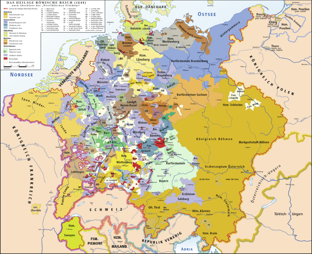
The Holy Roman Empire in 1789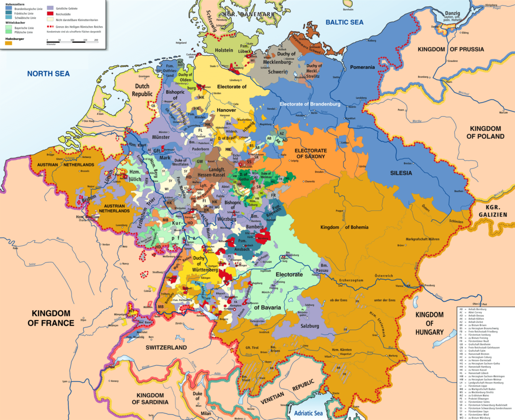


